[html]<style>@import url('/ipb/html/territory.css');</style>
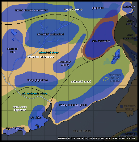
The Northern Tides territory consists of the land west of Nova Scotia: the Isthmus of Chignecto, the land bridge connecting the peninsula to the mainland; as well as the easternmost territories of New Brunswick, the Canadian mainland. Although it is a trek for many canines of the peninsula to come to this area, more and more have been traveling to Freetown and other parts unknown for trading and other purposes.
-
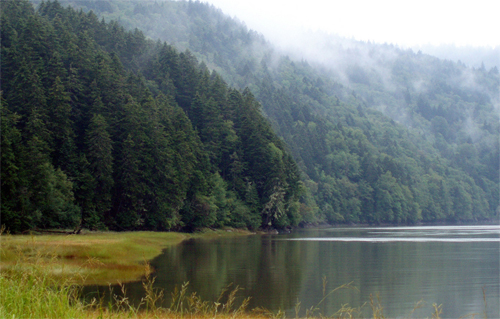
Climate: Although the climate of New Brunswick is maritime like Nova Scotia, it shares some similarities with mainland Canada. Winters are longer and colder, frequently accumulating more snow than the peninsula. Although the Northern Tides region experiences foggy days, the skies are generally clearer on this side of the bay.
-
Geography: The Northern Tides region rather mountainous, possessing various peaks of typical Appalachian size. Glacial valleys are commonplace, lush forests nestled within. The coast here is dominated by the Bay of Fundy and its extreme tides; unique features such as raised beaches and sea stacks are commonplace.
-
Demographics: The southern third of New Brunswick was the most populous before the apocalypse. Much of the human evidence elsewhere has faded with time; small villages hunker in vast forests. Most north-central farmland has already lost its battle with the wild overgrowth; the land almost appears untouched by humanity.
-
Prey: Abundant, with the exception of the hilliest and roughest terrain of high altitude, particularly north of Mount Oromocto.
-
Fauna: Many creatures found in this area are similar to those found on Nova Scotia. Unique to New Brunswick, however, are the Long Tailed and Gaspé Shrews, Big Brown Bat, Rock Vole, as well as both the Northern and Southern Bog Lemming.
-
Flora: The underbrush of the rockier terrain consists of Alpine Bilberry and Mountain Cranberry, along with the Northern Blueberry. Tree species found in the mixed forests include Eastern White Pine, Northern Red Oak, Balsam Fir, and Black Ash, among others.
- Areas @ 'Souls Wiki: The Wiki has various detailed information about the setting, including landmarks -- particular landforms, buildings, or other very small areas of note -- and past encounters in the area.
- Nova Scotia @ RP Guide: An in-depth guide to the Maritime province of Nova Scotia, Canada.
- Post Apocalypse @ RP Guide: A must-read for players interested in the apocalypse's effects on the world world.
- Travel Guide @ RP Guide: Need help figuring out traveling times and distances? Check this out!
[/html]
[html]
The Isthmus connects Nova Scotia with mainland Canada. The land bridge is surrounded by water, bordered on the north with the Northumberland Strait and to the south by the Bay of Fundy. Most of the land here is low and flat -- as much of it is below sea level, it is prone to flooding. In spring, one is hard-pressed to find so much as a footstep of dry ground, and the terrain seems made entirely of mud. The inland areas range from salt marsh to swamp, with a smattering of sparse, piney forest. The most populous area prior to humanity's demise was the city of Amherst, situated around the southerly bay.
Amherst
Amherst was a large and sprawling town in the time of humanity. Its remnants are a queer mix of early construction -- sprawling Victorian homes and stone churches -- and evidence of rising commercialism -- warehouses and big chain stores. The latter lined the long highways, clashing mightily with the old construction of Amherst on the smaller main streets. One thing both new warehouse and old Victorian share are the signs of natural reclamation -- even in this once-bustling town, signs of human occupation are decaying quickly. Saplings and shrubs sprout from cracks in the asphalt, and the sidewalks slowly lose their battle with the roots of elder trees.
Black River Reserve
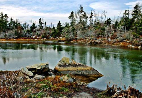
The Black River reserve, named for the largest of the reserve's numerous rivers, is located along the Northumberland coast. The shore boasts long and rolling sand dunes, along with small barrier islands. Most of the islands are bare of vegetation and become submerged with the high tide -- both the dunes and the islands provide a home for the Harbor and Gray seal species. The inland park primarily consists of salt marshes, lagoons and sparse coastal forests. Pines and other hardy sorts of trees out-compete most deciduous trees; thus, the area remains green throughout the winter.
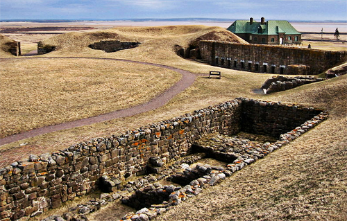
Fort Cumberland
This fort was built in the mid-eighteenth century and became a historical attraction in its later years. Stone barracks still stand, their construction intended to withstand centuries and cannons. The foundations of other buildings remain, though their wooden parts have rotted. Many of the buildings made completely of wood have fallen to ruin; the fort's stone-walled museum still stands, although the roof has collapsed. Much of the surrounding area consists of low, rolling hills and remains devoid of extensive tree growth.
[/html]
[html]
The coastal region on this side of the bay does not differ terribly from the Nova Scotian side; the tides are still ferociously strong, and the coastlands are subject to the whim of the sea. Much of the shore is extremely rocky and forbidding. The clearest difference between Nova Scotia and New Brunswick is the temperature: while the peninsula province's temperature is tempered by the surrounding water, New Brunswick's climate reflects that of mainland Canada. The winters are especially harsh, bringing snow and harsh cold to the Wabanaki Coast.
Fundy National Park
During the time of humanity, those seeking to escape daily life frequented this park's trio of campgrounds, golf course, swimming pool, and of course, the vast number of hiking trails. Now, decades after the apocalypse, the golf course is overgrown and the campgrounds are eerie and deserted; many of the hiking trails have been swallowed by the forest. A vast array of animal and plant species dwell in this territory; fishing is an effective pursuit along the shoreline and in the park's numerous rivers and lakes.
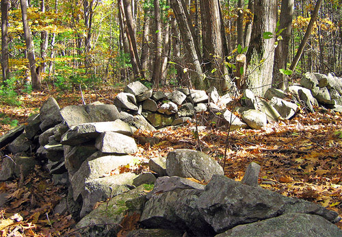
Commune of the Salmon
In the early 1980s, a group moved to the Fundy National Park without the government's permission. They were primitivists -- that is, they had a strong desire to live on the land and avoid the trappings of modern life. Their preoccupation with simple living did not save them from the virus, however, and they were exterminated as with the rest of humanity. Many chose to live in earth shelters -- e.g., homes built into the hillside itself. Much evidence of their existence has been reclaimed by the forest, although a single stone shack still stands. Additionally, a stone well sits beside the shack, drawing water from a deep underground aqueduct.
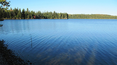
Grand Lake
Grand Lake is one of the larger lakes in the province. Its shores are dotted with the remnants of small villages of beach cottages, many of which depended on the fishing economy in the lake for sustenance. The northern shore is barren and bare, razed of trees during the time of humanity. Explanation for the peculiar baldness of the north coast lies with the sawmill also present on the same shore. Much of the machinery is damaged beyond repair, and many smaller outbuildings of the sawmill complex have completely collapsed.
[/html]
[html]
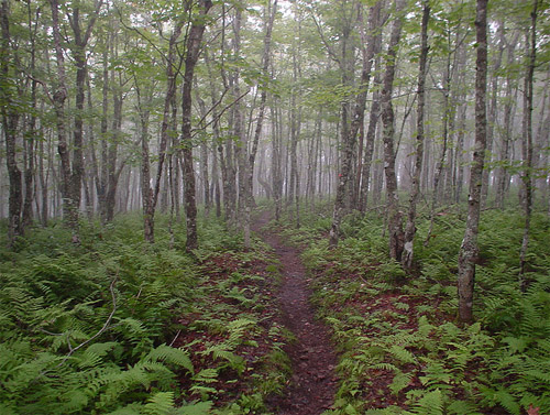
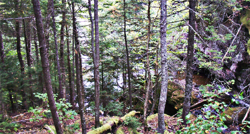
Much of the inner coast area of New Brunswick consists of lowland forest -- the Miramichi Wilderness is no exception. Most of the trees are broadleaf type; however, as the zone is a mixed forest, coniferous trees may be found here, as well. Sparsely populated prior to the demise of humanity, this thick forest sweeps down from Mount Oromocto and through the Miramichi Valley. The Wilderness is heavily pockmarked by various bodies of water: lagoons, lakes, ponds, rivers, creeks, streams, and all other manner of water bodies.
Miramichi Valley
The shallow Miramichi Valley is situated next to Mount Oromocto; the Miramichi River, the valley's namesake, snakes through the valley. Much of the valley was untamed wilderness prior to humanity's destruction; while land was privately owned, few people chose to reside here, instead, most maintained gardens and firewood lots. A few human villages remain scattered in the southerly half of the valley; however, more evidence of people is slowly washed away with each year's spring. While most rivers freeze solid in winter, the springtime brings considerable flooding to the Miramichi Valley.
Camp Gagetown
Camp Gagetown is a massive military base, operational until the human apocalypse. Camp Gagetown has a 1,129 km sq (436 sq mi) area -- it sprawls over the southern portion of the Miramichi Wilderness territory. Much of the terrain was landscaped significantly, as the military "designed" forests to create various training zones; additionally, in the early 1980s, strong herbicides were tested in the base's southern extremities. This particular patch of land is barren and very flat; nothing -- not even grass -- grows. These southerly "mudflats" are wide and the mud is very deep -- it is difficult for horses or canines to cross, and one is well-advised to avoid mess and other worse disaster by skirting the flats entirely.
Mount Oromocto
Mount Oromocto is the highest peak in the province of New Brunswick, dwarfing most of the Halcyon Mountains easily. The mountain is part of the Appalachian chain, and at its summit, a small fire-tower hut still stands, slowly falling into disrepair. Mount Oromocto is the source point for a few rivers and creeks, all of which snake slowly down its side, a few emptying into Grand Lake. There is a clear treeline about halfway up the mountain's face; past this treeline, the Mount Oromocto becomes bald rock and low, hardy shrubbery.
[/html]
[html]
The Saint Croix Highlands are rocky and mountainous, as the name suggests. Sparsely forested, this hilly land was unsuitable for farming or livestock pursuits; most of the construction in this area took place in the last century of humanity's reign. Thus, the buildings have begun to fall to ruin faster than those of older construction. Many small suburban towns have been overtaken by wilderness -- shrubs and other small plants force their way through cement and asphalt, and wooden houses come toppling down to earth.
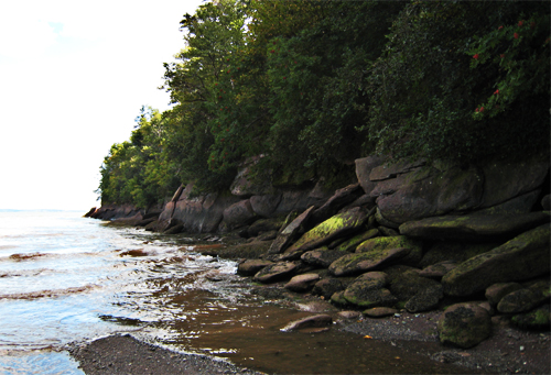
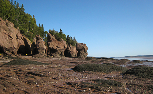
Cape Hopewell
Cape Hopewell is home to a variety of unique geological formations. Large boulders dot the shoreline, often found in sea stacks and other odd formations -- sheer drops and raised beaches are the norm. As any other along the Bay of Fundy, this area boasts an extremely varied tide. Hopewell Cape in particular, however, boasts some of the highest average tidal ranges in the world; the high tide can rise as much as 16 metres (52 ft). During low tide, there is plenty of beach and numerous tidal pools; however, during the high tide, the water comes to the cliff's edge.
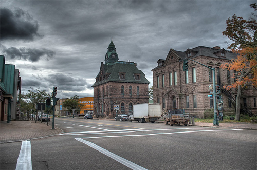
Saint John
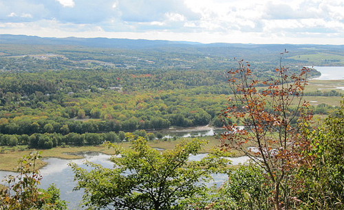
Although Halifax is larger than Saint John, this Atlantic coast city is as impressive, boasting tall buildings and a once-bustling metropolis. Like the Nova Scotian city, Saint John is also situated on a harbor. Many buildings closest to the shoreline are in the worst disrepair; a few have fallen into the harbor entirely. Inland construction is more secure, but all show wear and signs of nature's march forward. Four distinctive neighborhoods form Saint John city: residential, retail, commercial, and working class. In general, Saint John is in worse shape than Halifax, primarily due to the colder and harsher climate of mainland Canada.
[/html]
|
")
")


