")
")
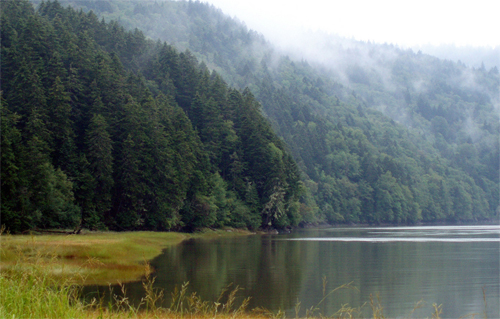
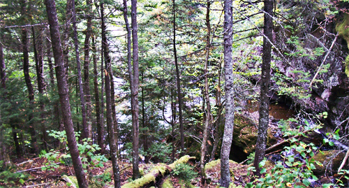
Much of the inner coast area of New Brunswick consists of lowland forest -- the Miramichi Wilderness is no exception. Most of the trees are broadleaf type; however, as the zone is a mixed forest, coniferous trees may be found here, as well. Sparsely populated prior to the demise of humanity, this thick forest sweeps down from Mount Oromocto and through the Miramichi Valley. The Wilderness is heavily pockmarked by various bodies of water: lagoons, lakes, ponds, rivers, creeks, streams, and all other manner of water bodies.
- More on the 'Souls Wiki
The shallow Miramichi Valley is situated next to Mount Oromocto; the Miramichi River, the valley's namesake, snakes through the valley. Much of the valley was untamed wilderness prior to humanity's destruction; while land was privately owned, few people chose to reside here, instead, most maintained gardens and firewood lots. A few human villages remain scattered in the southerly half of the valley; however, more evidence of people is slowly washed away with each year's spring. While most rivers freeze solid in winter, the springtime brings considerable flooding to the Miramichi Valley.
- More on the 'Souls Wiki
Camp Gagetown is a massive military base, operational until the human apocalypse. Camp Gagetown has a 1,129 km sq (436 sq mi) area -- it sprawls over the southern portion of the Miramichi Wilderness territory. Much of the terrain was landscaped significantly, as the military "designed" forests to create various training zones; additionally, in the early 1980s, strong herbicides were tested in the base's southern extremities. This particular patch of land is barren and very flat; nothing -- not even grass -- grows. These southerly "mudflats" are wide and the mud is very deep -- it is difficult for horses or canines to cross, and one is well-advised to avoid mess and other worse disaster by skirting the flats entirely.
- More on the 'Souls Wiki

Mount Oromocto is the highest peak in the province of New Brunswick, dwarfing most of the Halcyon Mountains easily. The mountain is part of the Appalachian chain, and at its summit, a small fire-tower hut still stands, slowly falling into disrepair. Mount Oromocto is the source point for a few rivers and creeks, all of which snake slowly down its side, a few emptying into Grand Lake. There is a clear treeline about halfway up the mountain's face; past this treeline, the Mount Oromocto becomes bald rock and low, hardy shrubbery.
- More on the 'Souls Wiki